make preferable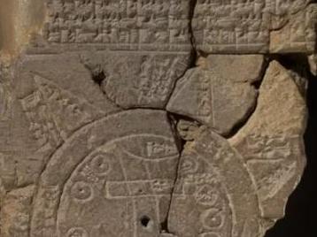
A team of scientists from the British Museum have managed to decipher the world's oldest map and claim it may show the location of Noah's Ark, reports The Sun.
Specialists have been trying to decipher the Imago Mundi clay brick carvings for a long time.
The Babylonian tablet was discovered in 1882 in the Middle East, and dates back to the 6th century BC.
On the opposite side of the brick is the scheme-map with cuneiform inscriptions. They describe the structure of the Earth. Researchers believe that there are references to the biblical story here.
But the reverse side of the Imago Mundi is a puzzle that points the path to Noah's Ark.
One section reportedly says anyone on the journey must go through "seven leagues to see something that is thick as a parsiktu-vessel." That's what other Babylonian designs called Noah's Ark.
Another passage also appears to show a path to "Urartu" followed by instructions on how to get there. Urartu is believed to be the place where a man and his family landed a gigantic ark they had made, according to ancient Mesopotamian poems. And as per scientists, that place is located in Iran.